How to decide where to put an offshore platform

The number 1 online oil and gas marketplace
When a major oil and gas operator wanted a new concrete gravity based platform placed in their existing subsea field, they asked us to figure out where to put it. At first it may seem like an easy task, pick a nice flat piece of seabed and job done. It is not that simple, however, and it took a multi-disciplinary team to get the optimum solution. Like all engineering issues, it is all about weighing the trade-offs between alternatives.
It is not always about drilling...
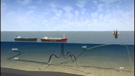
When placing an offshore platform in a greenfield development, the drilling and completion factors will likely dominate, but the situation becomes more complex when a platform is being installed in a field under development. Environmental areas such as decommissioned assets in use as reefs, or commercial fishing or navigation channels reduce the alternatives for platform positioning. While issues like spud cans and approach quadrants are important factors with adjacent platforms, subsea infrastructure poses additional constraints as the existing drill centers, flowlines and manifolds can be in positions which may interfere with platform placement.
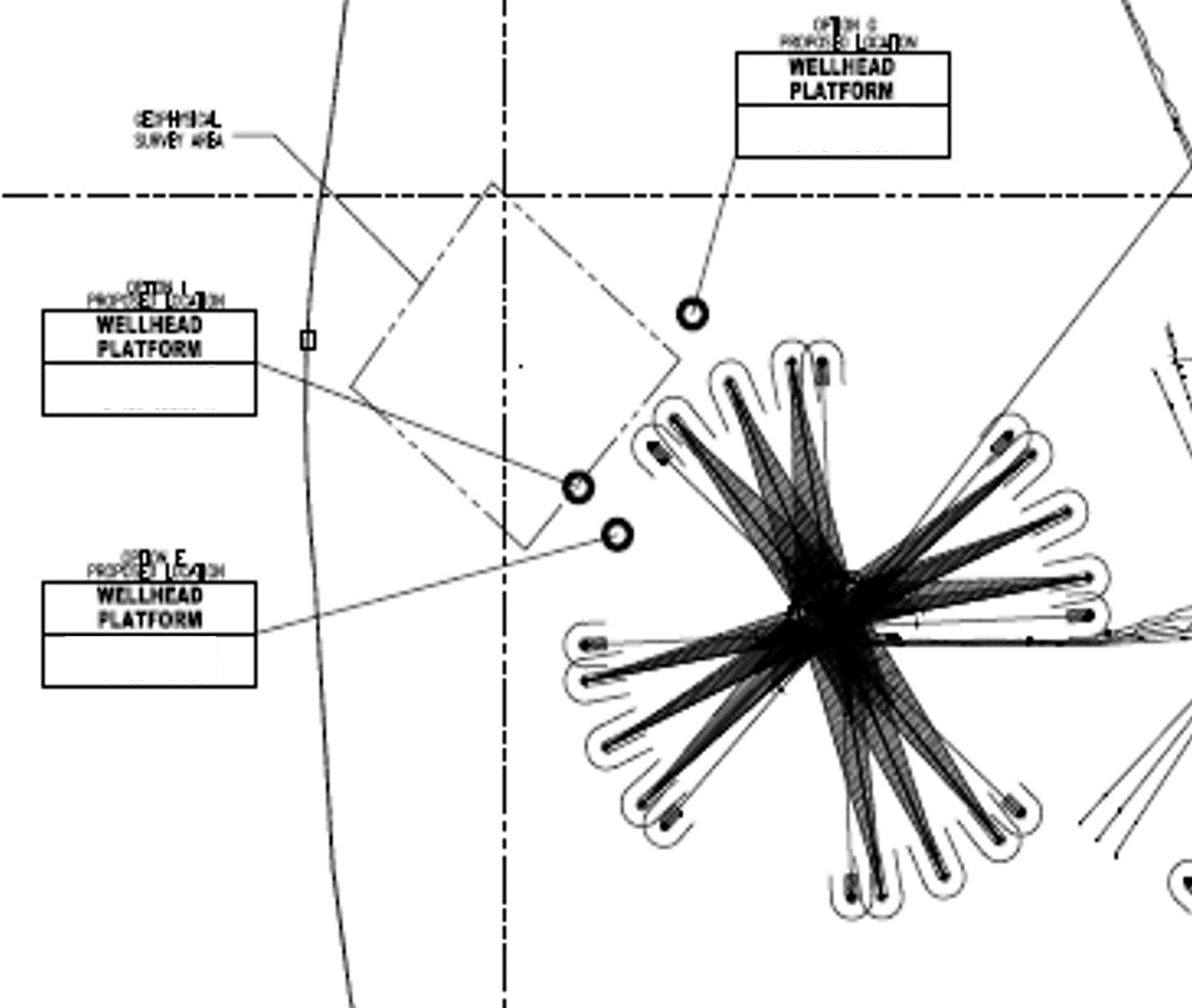
In shallower water depths there may be special environmental conditions such as fish habitat or commercial fishing which should be given adequate space. If the platform is planned to provide power to subsea infrastructure, the cable distances may play a role. Subsea instrumentation or fibre-optic cables may also be a consideration, as the ability to make a short connection to a subsea fiber optic cable can open a world of data gathering and analytic opportunities. Some of the most important data to gather in an oil and gas asset can be seismic data, and most likely 3-D seismic has already been shot in a field where a new platform is being installed, however, the seismic lines should also be mapped in the event that a future 4-D (or pseudo 4-D) seismic campaign would occur. Placing the platform on an existing 3-D seismic line can be compensated by the seismic vessel altering course around the platform, and using post processing to correct the offset, but if this can be avoided it will provide higher quality data in the future.